Gulf of Cadiz - Geographic Area
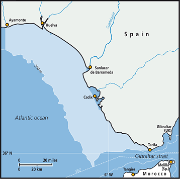 (spatial coordinates: 36ºN – 37º13’N; 5º30’W – 7º24’, surface: 8,500 km2)
The Gulf of Cadiz is located in the northern sector of the Canary Current System, one of the four Eastern Boundary Upwelling Systems (EBUS) of the world. Its northern, eastern and southern boundaries are the southwest coasts of the Iberian Peninsula, the Strait of Gibraltar and the Atlantic coast of Morocco, respectively. The northern Gulf of Cadiz (SW Spain), is a complex hydrodynamic region where two oceanographic subsystems can be identified: The Huelva sector in the north, spanning 120 km from the mouth of the transnational (Spain-Portugal) Guadiana river (37º 13’N - 7º 24’W) to the mouth of the Guadalquivir river (36º 32’N – 6º 21’W), while the Cadiz sector extends 100 km south-east to the Gibraltar Strait (36ºN – 5º30’W).
FAO Fishing Areas: [ 27.IXa ]